alexsidles
Paddler
Sorry for the misleading title. There’s actually no such thing as the Quadrangle of Fire. That’s just a little joke I made up. In reality, Washington State only has a Triangle of Fire. I added an extra angle just for this kayak trip!
Washington’s Triangle of Fire is a series of coastal defense forts built in the 1890s and 1900s. The three forts—Fort Casey, Fort Worden, and Fort Flagler—are positioned along both sides of Admiralty Inlet, the body of water that connects Puget Sound to the Strait of Juan de Fuca.
Admiralty Inlet is itself a misnomer. An inlet is a landform consisting of a long, narrow indentation in a coastline, which Admiralty Inlet is not. Properly speaking, it should be called Admiralty Strait or perhaps Admiralty Sound.
Despite its awkward name, Admiralty Inlet was strategically important at the end of the 19th century. Boundary disputes with Great Britain (the world’s strongest naval power) and conflicts over influence in Latin America with Spain (the world’s fourth strongest naval power) led the Untied States to fear a naval attack. Under the leadership of Secretary of War William Endicott, the country embarked on an ambitious program of fort building along key parts of the coast. Here in Washington, the chief Endicott Period forts were the Triangle of Fire, all of which were completed by 1902.
After the United States entered World War II in 1941, a fourth fort was added along Admiralty Inlet, Fort Ebey. Fort Ebey was only manned from 1944 to 1946 and was neither an Endicott Period fort nor a member of the Triangle of Fire.
Today, all four Admiralty Inlet forts (the Triangle forts plus Ebey) are state parks. When I was growing up, my family took many trips out to Fort Casey, and I have happy memories of chasing my brother and other kids around the fort’s tangled maze of causeways, passages, and landings. I also have my more recent and very enjoyable kayak trip to Goat Island to visit Fort Whitman, which served as an Endicott Period backup to the Triangle of Fire, preventing enemy fleets from sneaking in the back door through Deception Pass. A visit to a fort is never wasted, and today, each of the four Admiralty Inlet forts has a campground, so I thought it would be a fun trip to kayak out to each one, camping overnight as needed.

00 Route map: three-day, two-night clockwise tour starting from Fort Worden.
I’d been waiting months to do this Quadrangle of Fire tour. Admiralty Inlet is known for fast currents and strong winds. It can be dangerous to kayakers. For safety’s sake, I needed to wait for late summer, when surface cyclones are rare and daylight lasts long enough to accommodate waiting for tides to change.
What with the need to make not one but two crossings of Admiralty Inlet and with a budget of several hours for each fort, I decided a three-day, two-night itinerary would work best for the Quadrangle of Fire. To get an early start and catch the favorable ebb, I car camped at Fort Worden outside Port Townsend, adding a third night.
Car camping featured its usual hellish orchestra of chugging diesels, slamming doors, buzzing air conditioners on RVs, and raucous, drunken laughter. Washington State has been choked with wildfire smoke lately, but the terrible air quality did not stop one particularly maniacal group of car campers from igniting a blazing bonfire that left my eyes watering inside my tent. The only consolation was a duet of barred owls that spent an hour calling back and forth from opposite sides of the campground.
In the morning, I stashed my car in the beachfront parking lot (Discover Pass required) and launched into the tail end of the ebb, bound for Fort Ebey. Within five minutes, I spotted the Big Four alcids: marbled murrelet, common murre, rhinoceros auklet, and pigeon guillemot. Seeing the Big Four is always the sign of a good trip, and to see them so early made me hopeful that the Quadrangle of Fire tour was going to be good.

01 Heermann's gulls at launch beach. August is the best month in our region for seeing this very handsome gull.

02 Army logistics support vessel in Admiralty Inlet. The extreme haze is due to wildfires, limiting visibility to around seven miles (11 km).

03 Point Wilson lighthouse. Point Wilson is famous for extensive tide rips, but they weren't too bad on this fading ebb and close to shore.

04 Crossing Admiralty Inlet toward Fort Ebey under calm conditions. Partridge Point, Whidbey Island is the destination, visible on the far left of the island.

05 Looking south down Admiralty Inlet. The smoke created amazing lighting effects throughout the day.

06 Rhinoceros auklet flock in Admiralty Inlet. Rhino auklets are the friendliest towards humans of the Big Four alcids.
Big ships traverse Admiralty Inlet every half hour or so, on top of which you also have the constant cycle of the Port Townsend–Coupeville ferry, plus the swarms of powerboats and sailing yachts. With all this traffic, crossing the inlet in a kayak is a bit like playing Frogger! Luckily, such a strong ebb was working in my favor that I occasionally hit speeds of seven miles per hour (11 kph), a blistering pace for a folding kayak. The entire five-mike crossing to Fort Ebey took me only 45 minutes.

07 View from Partridge Point. A lovely, mile-long trail along the bluff connects the Cascade Marine Trail campsite to Fort Ebey.

08 Fort Ebey base end station. This is not a bunker used for defense; it's a base end station used to triangulate the position of approaching ships by comparing azimuths shot from this position with azimuths shot from other positions in the vicinity.

09 Fort Ebey six-inch gun battery. Fort Ebey is much smaller than the forts of the Triangle of Fire.

10 Fort Ebey battery commander's station. From this underground bunker, the battery commander assigned targets to his guns.
After visiting the ruins of Fort Ebey, my original plan was to catch the flood tide down to Fort Casey and overnight there. But just as I was loading up to depart, it occurred to me I didn’t know where the Cascadia Marine Trail campsite was at Fort Casey. That there was a campground I knew, but marine trail campsites are specially reserved for kayakers and also tend to be nicer and more isolated than the sites for car campers.
But when I checked WWTA’s website, I learned that alone of the four Admiralty Inlet forts, Casey only has a car campground, not a marine trail site. This being August, all the car campsites were booked. I’d have showed up at Casey and found nowhere to camp at the end of a long day! Luckily, Fort Ebey has a beautiful marine trail site, so I settled in for a long afternoon on the beach. Fort Casey would become a day stop on my way to Fort Flagler the next morning.
Secretly, I didn’t mind. The rising tide had eventually generated surf conditions on the beach at Fort Ebey, far more than when I’d landed at low tide. Soon, two- and three-foot waves were dumping onshore. A dozen surfers even showed up and rode waves for a few hours, never a good sign when one is contemplating a kayak launch!

11 Fort Ebey is home to the world's least convenient water fountain.

12 Beach at Fort Ebey State Park. Sandy beaches are rare in the inland waters, so camping on one is a real treat.

13 Sunset at Fort Ebey State Park. The marine trail campsite is accessible by cars, but car drivers may not camp here; their campground is on the other side of the park.
The change to my itinerary meant facing an adverse current on the way to Fort Casey. I crawled along at a snail’s pace, outraced even by couples strolling leisurely along the sandy beaches of Whidbey Island. Not til late morning did the current turn, and it created tide races when it did. I was already wearing my dry suit due to the surprisingly chill air, so the tide races did not disconcert me as they sometimes do.

14 Paddling south along Whidbey Island shore toward Fort Casey. Kelp beds and tide races were frequent.

15 Ten-inch gun at Fort Casey. Fort Casey is the only one of the forts to have guns installed today.

16 Main gun line at Fort Casey. The disappearing carriages would drop the guns below the parapet after every shot to aid concealment and hasten reloading.

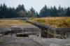
17 Shell receiving area at Fort Casey. The walkways and gantries and tunnels make for wonderful exploring.

18 Playing on shell transportation system at Fort Casey. I was fortunate enough to catch a guided tour of the fort that took us through some of the magazines that are normally off-limits to visitors.

19 Shell hoist at Fort Casey. Each of these ten-inch shells weighs 620 pounds (280 kg)! The two furthest ones are mock-ups but the closest one is real.
CONTINUED IN NEXT POST
Washington’s Triangle of Fire is a series of coastal defense forts built in the 1890s and 1900s. The three forts—Fort Casey, Fort Worden, and Fort Flagler—are positioned along both sides of Admiralty Inlet, the body of water that connects Puget Sound to the Strait of Juan de Fuca.
Admiralty Inlet is itself a misnomer. An inlet is a landform consisting of a long, narrow indentation in a coastline, which Admiralty Inlet is not. Properly speaking, it should be called Admiralty Strait or perhaps Admiralty Sound.
Despite its awkward name, Admiralty Inlet was strategically important at the end of the 19th century. Boundary disputes with Great Britain (the world’s strongest naval power) and conflicts over influence in Latin America with Spain (the world’s fourth strongest naval power) led the Untied States to fear a naval attack. Under the leadership of Secretary of War William Endicott, the country embarked on an ambitious program of fort building along key parts of the coast. Here in Washington, the chief Endicott Period forts were the Triangle of Fire, all of which were completed by 1902.
After the United States entered World War II in 1941, a fourth fort was added along Admiralty Inlet, Fort Ebey. Fort Ebey was only manned from 1944 to 1946 and was neither an Endicott Period fort nor a member of the Triangle of Fire.
Today, all four Admiralty Inlet forts (the Triangle forts plus Ebey) are state parks. When I was growing up, my family took many trips out to Fort Casey, and I have happy memories of chasing my brother and other kids around the fort’s tangled maze of causeways, passages, and landings. I also have my more recent and very enjoyable kayak trip to Goat Island to visit Fort Whitman, which served as an Endicott Period backup to the Triangle of Fire, preventing enemy fleets from sneaking in the back door through Deception Pass. A visit to a fort is never wasted, and today, each of the four Admiralty Inlet forts has a campground, so I thought it would be a fun trip to kayak out to each one, camping overnight as needed.
00 Route map: three-day, two-night clockwise tour starting from Fort Worden.
I’d been waiting months to do this Quadrangle of Fire tour. Admiralty Inlet is known for fast currents and strong winds. It can be dangerous to kayakers. For safety’s sake, I needed to wait for late summer, when surface cyclones are rare and daylight lasts long enough to accommodate waiting for tides to change.
What with the need to make not one but two crossings of Admiralty Inlet and with a budget of several hours for each fort, I decided a three-day, two-night itinerary would work best for the Quadrangle of Fire. To get an early start and catch the favorable ebb, I car camped at Fort Worden outside Port Townsend, adding a third night.
Car camping featured its usual hellish orchestra of chugging diesels, slamming doors, buzzing air conditioners on RVs, and raucous, drunken laughter. Washington State has been choked with wildfire smoke lately, but the terrible air quality did not stop one particularly maniacal group of car campers from igniting a blazing bonfire that left my eyes watering inside my tent. The only consolation was a duet of barred owls that spent an hour calling back and forth from opposite sides of the campground.
In the morning, I stashed my car in the beachfront parking lot (Discover Pass required) and launched into the tail end of the ebb, bound for Fort Ebey. Within five minutes, I spotted the Big Four alcids: marbled murrelet, common murre, rhinoceros auklet, and pigeon guillemot. Seeing the Big Four is always the sign of a good trip, and to see them so early made me hopeful that the Quadrangle of Fire tour was going to be good.
01 Heermann's gulls at launch beach. August is the best month in our region for seeing this very handsome gull.
02 Army logistics support vessel in Admiralty Inlet. The extreme haze is due to wildfires, limiting visibility to around seven miles (11 km).
03 Point Wilson lighthouse. Point Wilson is famous for extensive tide rips, but they weren't too bad on this fading ebb and close to shore.
04 Crossing Admiralty Inlet toward Fort Ebey under calm conditions. Partridge Point, Whidbey Island is the destination, visible on the far left of the island.
05 Looking south down Admiralty Inlet. The smoke created amazing lighting effects throughout the day.
06 Rhinoceros auklet flock in Admiralty Inlet. Rhino auklets are the friendliest towards humans of the Big Four alcids.
Big ships traverse Admiralty Inlet every half hour or so, on top of which you also have the constant cycle of the Port Townsend–Coupeville ferry, plus the swarms of powerboats and sailing yachts. With all this traffic, crossing the inlet in a kayak is a bit like playing Frogger! Luckily, such a strong ebb was working in my favor that I occasionally hit speeds of seven miles per hour (11 kph), a blistering pace for a folding kayak. The entire five-mike crossing to Fort Ebey took me only 45 minutes.
07 View from Partridge Point. A lovely, mile-long trail along the bluff connects the Cascade Marine Trail campsite to Fort Ebey.
08 Fort Ebey base end station. This is not a bunker used for defense; it's a base end station used to triangulate the position of approaching ships by comparing azimuths shot from this position with azimuths shot from other positions in the vicinity.
09 Fort Ebey six-inch gun battery. Fort Ebey is much smaller than the forts of the Triangle of Fire.
10 Fort Ebey battery commander's station. From this underground bunker, the battery commander assigned targets to his guns.
After visiting the ruins of Fort Ebey, my original plan was to catch the flood tide down to Fort Casey and overnight there. But just as I was loading up to depart, it occurred to me I didn’t know where the Cascadia Marine Trail campsite was at Fort Casey. That there was a campground I knew, but marine trail campsites are specially reserved for kayakers and also tend to be nicer and more isolated than the sites for car campers.
But when I checked WWTA’s website, I learned that alone of the four Admiralty Inlet forts, Casey only has a car campground, not a marine trail site. This being August, all the car campsites were booked. I’d have showed up at Casey and found nowhere to camp at the end of a long day! Luckily, Fort Ebey has a beautiful marine trail site, so I settled in for a long afternoon on the beach. Fort Casey would become a day stop on my way to Fort Flagler the next morning.
Secretly, I didn’t mind. The rising tide had eventually generated surf conditions on the beach at Fort Ebey, far more than when I’d landed at low tide. Soon, two- and three-foot waves were dumping onshore. A dozen surfers even showed up and rode waves for a few hours, never a good sign when one is contemplating a kayak launch!
11 Fort Ebey is home to the world's least convenient water fountain.
12 Beach at Fort Ebey State Park. Sandy beaches are rare in the inland waters, so camping on one is a real treat.
13 Sunset at Fort Ebey State Park. The marine trail campsite is accessible by cars, but car drivers may not camp here; their campground is on the other side of the park.
The change to my itinerary meant facing an adverse current on the way to Fort Casey. I crawled along at a snail’s pace, outraced even by couples strolling leisurely along the sandy beaches of Whidbey Island. Not til late morning did the current turn, and it created tide races when it did. I was already wearing my dry suit due to the surprisingly chill air, so the tide races did not disconcert me as they sometimes do.
14 Paddling south along Whidbey Island shore toward Fort Casey. Kelp beds and tide races were frequent.
15 Ten-inch gun at Fort Casey. Fort Casey is the only one of the forts to have guns installed today.
16 Main gun line at Fort Casey. The disappearing carriages would drop the guns below the parapet after every shot to aid concealment and hasten reloading.
17 Shell receiving area at Fort Casey. The walkways and gantries and tunnels make for wonderful exploring.
18 Playing on shell transportation system at Fort Casey. I was fortunate enough to catch a guided tour of the fort that took us through some of the magazines that are normally off-limits to visitors.
19 Shell hoist at Fort Casey. Each of these ten-inch shells weighs 620 pounds (280 kg)! The two furthest ones are mock-ups but the closest one is real.
CONTINUED IN NEXT POST