Nick Heath
Paddler
- Joined
- Mar 27, 2008
- Messages
- 38
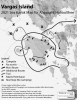
Do WCP members have experience of paddling in the area of Vargas I after the announcement by the Ahousaht First Nation that a $15/day 'voluntary' user fee be imposed, along with access changes to some sites?
I'm both curious and concerned about a possible bad precedent having being set after the area commercial operators caved on this demand in Spring 2021, and without the independent paddling community being consulted, or so it seems to me.
I'm both curious and concerned about a possible bad precedent having being set after the area commercial operators caved on this demand in Spring 2021, and without the independent paddling community being consulted, or so it seems to me.